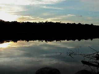
St. Croix National Scenic Riverway.
Free flowing and unpolluted, the Namekagon and St. Croix Rivers flow through some of the most scenic and least developed country in the Upper Midwest. Today 405 kilometers (252 miles) of these rivers are preserved as part of the National Wild and Scenic Rivers System. The St. Croix National Scenic Riverway, which includes the Namekagon, was established in 1968 as one of the original eight rivers under the National Wild and Scenic Rivers Act. The Lower St. Croix National Scenic Riverway was added to the system in 1972. Together they form a Riverway that offers outdoor enthusiasts a chance to enjoy a wilderness like experience and a variety of outdoor recreation opportunities within easy reach of a major metropolitan area. On the upper St. Croix and Namekagon Rivers, rapids challenge the canoeist, although none of the Riverway's waters are classified as whitewater. At the lower end, where the river widens out as Lake St. Croix, power and sail boating are popular. Campers, picnickers, swimmers, and birdwatchers enjoy its variety of scenes throughout. Anglers are attracted by the variety of fish lurking in the rivers, from trout and bass to muskellunge and sturgeon. The Riverway is managed through the cooperative efforts of the National Park Service, Minnesota and Wisconsin Departments of Natural Resources, and Northern States Power Company.

St. Croix scenic riverway picnic area.
On the Wisconsin side, South of the Hi-way 70 bridge.
 Picnic/parking area.

Trail to Picnic area next to the river.
Upper St. Croix and Namekagon
The upper St. Croix and Namekagon part of the Riverway offers varied canoe environments on 322 kilometers (200 miles) of rivers. The Namekagon River begins at Namokagon Lake dam. It lies entirely in Wisconsin, flowing 158 kilometers (98 miles) south and west to join the St. Croix River near Danbury. The Namekagon begins as a narrow trout stream closed in by forest and meanders through a wide valley for much of its length. The river occasionally widens into marshy or swamplike areas popular for waterfowl watching. The lower Namekagon passes through an area of high sandy banks with many sharp bends. This stretch offers canoeists a wilderness-like experience because very little development is visible from the river. At four areas, dams form lake-like stretches called flowages. You can end canoe trips above these flowages, to avoid the slack water, or start below the dams, to avoid having to portage.
The St.Croix Riverway starts at a dam near gordon, Wisconsin. It flows southerly for 164 kilometers (102 miles) to the dam at St. Croix Falls, Wisconsin. It lies in Wisconsin for its first 40 kilometers (25 miles) and then becomes the border river between Minnesota and Wisconsin until it flows into the Mississippi River. The St. Croix begins as a small spring. It is narrow and shallow until joined by its major tributary, the Namekagon, 32 kilometers (20 miles) downstream. It then becomes wider, deeper, and slower. For most of its length it flows through a wide valley with low banks, formed by the glacial activity that shaped both rivers' watersheds. The St. Croix passes two Minnesota State Parks that provide developed camping areas. (The Namekagon and upper St. Croix offer primitive sites.) The upper Riverway's last 16 kilometers (10 miles) are the lndianhead Flowage created by the 18-meter-(60-foot) high St. Croix Falls hydroelectric dam.
Most canoeists take out upstream of the flowage to avoid the slack water. Small powerboat activities such as water skiing and deeper-water fishing take place on this flowage. Many low and medium hazard rapids and a few high hazard rapids exist on the St. Croix and Namekagon Rivers, but they are not considered whitewater rivers. Recreation here includes fishing, hunting, inner tubing, picnicking, and canoeing, with small powerboating on the flowages. Most camping is at canoe-access primitive sites. Recreational vehicle camping areas can be found within the state parks or private campgrounds located near the Riverway.

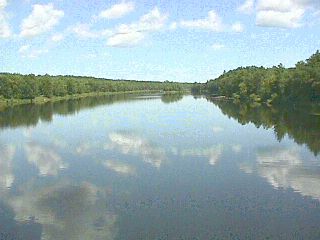
View from Hi-Way 70 bridge.
The Lower St. Croix National Scenic Riverway covers a narrow river and shoreline corridor for 84 kilometers (52 miles) from St. Croix Falls dam to Prescott, Wisconsin, where the river joins the Mississippi. The lower St. Croix is wider, deeper, and slower than the upper, its flow controlled by the hydroelectric dam at its upstream end. Downstream of the dam are the high cliffs of the Dallas, which formed as meltwaters from retreating glaciers cut a deep, vertical-walled gorge through bedrock. For about 3.2 kilometers (2 miles) here the St. Croix, in places 21-30 meters (70-100 feet) deep, flows itsfastest.The Dallas mostly lie within two Interstate State Parks. Both offer short hiking trails to geologicfeatures, and developed campgrounds, swimming beaches, picnic areas, and boat launch ramps. On the Minnesota side you can rent a canoe or take a boat tour to see the scenic Dallas from the best vantage point, right on the water.
As it leaves the Dallas, the river becomes wider and shallower and passes between high banks for the next 32 kilometers (20 miles). Although development is visible from the water for 24 kilometers (15 miles) on this stretch, it is Popular with canoeists. The shallower water, lack of rapids, and absence of large powerboat waves make it suitable for beginning canoeists.
About 35 kilometers (22 miles) below the dam the Apple River flows into the St. Croix, creating a large sandbar. Near here the river becomes deeper and slower-moving. Large powerboating becomes the major use. Forty-three kilometers (27 miles) downstream the valley widens still more and, for the last 40 kilometers (25 miles) of Riverway, the river is known as Lake St. Croix. Here you enter the state-administered area. From near Stillwater, Minnesota, the Riverway's largest city, south to Afton, Minnesota, shoreline.
Development is more visible and the area is classified recreational. Near Hudson, Wisconsin, south of Stillwater, the river reaches its maximum width, 2,255 meters (7,400 feet) and sailboating predominates. Further south the river passes two developing state parks, one on either side.
Recreation on the Lower St. Croix includes canoeing, fishing, powerboating, water skiing, and sailboating. Tour boat rides are offered at Interstate State Park near Taylor Falls, Minnesota, and at Stillwater. The three developed state parks offer developed campgrounds, hiking trails, picnic areas, and swimming beaches. Find limited primitive campsites at shoreline points and on islands. Special water-use regulations apply on the lower Riverway.

High Way 70 bridge
|


